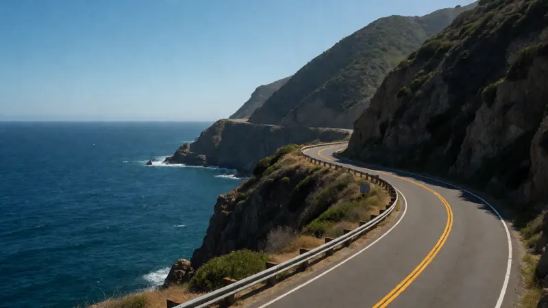
Driving the Pacific Coast Highway is a dream for travelers worldwide, offering breathtaking vistas of crashing waves and towering cliffs. However, the stretch from Carmel-by-the-Sea to San Luis Obispo presents a unique set of challenges, from navigating winding cliffside roads to managing time effectively amidst dozens of potential stops. Many visitors underestimate the driving focus required and the lack of cellular service, leading to missed landmarks and unnecessary stress.
Planning this route requires more than just a full tank of gas; it demands a strategic itinerary to ensure safety and enjoyment. Without a plan, travelers often find themselves rushing through the most scenic portions or getting stuck behind slow-moving convoys during peak hours. The drive from Carmel to San Luis Obispo covers approximately 135 miles along Highway 1 and typically takes 3 to 5 hours without stops, but travelers should budget a full day to enjoy iconic landmarks like Bixby Bridge and McWay Falls safely.
This comprehensive guide addresses the common pain points of this coastal journey. By breaking down the essential stops, safety logistics, and timing strategies, you can transform a daunting drive into an unforgettable adventure. Prepare to explore the rugged beauty of the California Central Coast with confidence and ease.
Planning Your Drive: Logistics and Safety
Before hitting the road, understanding the logistics of Highway 1 is crucial for a smooth experience. The road is famous for its hairpin turns and narrow lanes, which can be intimidating for unseasoned drivers. Preparation is the key to enjoying the views without the anxiety of the drive.
Checking Road Status and Weather
The most critical step in planning this trip is verifying the status of Highway 1. Landslides and erosion frequently cause closures, particularly around the Big Sur area during or after rainy seasons. Always consult the Caltrans website for the most up-to-date road information before departure. Ignoring this step can lead to hours of backtracking.
Weather along the coast is notoriously unpredictable, often shifting from sunny to foggy within miles. Coastal fog, known as “June Gloom,” can obscure views even in summer months. The best visibility is often found in late summer (September and October), offering clear skies and manageable temperatures.
Navigation and Connectivity
One of the most overlooked aspects of the journey from Carmel to San Luis Obispo is the severe lack of cell service. For nearly 60 miles through Big Sur, your phone will likely have “No Service.” Relying solely on live GPS data is a recipe for frustration.
Download Offline Maps
Before leaving the Wi-Fi range of Carmel, download offline maps for the entire Central Coast region. This ensures you can still identify turnouts and landmarks without a data connection. Bringing a physical map is also a wise backup plan.
Direction of Travel Strategy
While the route is spectacular in both directions, driving from North to South (Carmel to San Luis Obispo) is generally recommended. This puts your vehicle in the lane closest to the ocean, providing unobstructed views of the coastline. It also makes pulling into scenic turnouts significantly easier and safer, as you do not have to cross oncoming traffic.
Essential Stops: The Big Sur Stretch
The section immediately following Carmel is the most iconic portion of the drive. Here, the Santa Lucia Mountains rise abruptly from the Pacific Ocean, creating dramatic scenery that demands attention. Prioritizing stops here is essential to avoid driver fatigue.
Point Lobos State Natural Reserve
Often called the “crown jewel” of the state park system, Point Lobos offers unparalleled hiking and wildlife viewing just south of Carmel. The trails here are relatively short and accessible, allowing for a quick but rewarding immersion in nature. Look for sea otters floating in the kelp beds and migrating whales further out to sea.
Parking Considerations
Parking lots at Point Lobos fill up rapidly, often by mid-morning. Arriving early is the best strategy to secure a spot. If the main lots are full, parking is sometimes available on the shoulder of Highway 1, though this requires a walk into the reserve.
Bixby Creek Bridge Photo Ops
No trip from Carmel to San Luis Obispo is complete without seeing Bixby Creek Bridge. This architectural marvel is one of the most photographed bridges in California. There are turnouts on the north side of the bridge that offer the classic vantage point.
Safety at Turnouts
The turnouts at Bixby Bridge can be chaotic with pedestrians and cars. Exercise extreme caution when entering and exiting the highway. Do not stop in the middle of the road for a photo; always pull completely off the pavement.
Pfeiffer Big Sur State Park
Further south, the landscape shifts from coastal scrub to towering redwoods. Pfeiffer Big Sur State Park offers a chance to walk among these giants without venturing too far inland. It is an excellent spot for a mid-day picnic or a restroom break.
McWay Falls at Julia Pfeiffer Burns
McWay Falls is an 80-foot waterfall that cascades directly onto the beach, a rare geological feature known as a tidefall. The trail to the overlook is short and flat, making it accessible for most travelers. The turquoise waters of the cove provide a stunning contrast to the rugged cliffs.
Hidden Gems and Unique Detours
Beyond the famous landmarks, the route holds several quieter spots that offer solitude and unique beauty. These locations often have fewer crowds, allowing for a more intimate connection with the landscape. Adding one or two of these to your itinerary adds significant value to the trip.
Partington Cove
For those willing to hike a steep trail, Partington Cove offers a glimpse into the region’s history. The trail leads through a 60-foot tunnel carved into the rock in the 1880s for transporting tanbark. Emerging from the tunnel onto the rocky cove feels like stepping back in time.
Limekiln State Park
This park offers a unique combination of breathtaking coastal views and deep redwood canyons. It also features historic lime kilns used in the late 19th century. The juxtaposition of industrial history and ancient forest makes for a fascinating stop.
Ragged Point
Known as the “Gateway to Big Sur” when coming from the south, Ragged Point provides a crucial rest stop. The views here are jagged and steep, earning it the name “The Million Dollar View.” It is a perfect place to stretch your legs and grab a coffee before continuing the drive.
San Simeon and Cambria: History and Wildlife
As the winding roads of Big Sur straighten out, the landscape opens up into rolling hills and pastures. This section marks the transition from the rugged cliffs to the gentler coast of San Luis Obispo County. The attractions here shift from geological wonders to wildlife and history.
Piedras Blancas Elephant Seal Rookery
Just north of San Simeon, the Piedras Blancas rookery is home to thousands of elephant seals. Depending on the season, visitors can see pups, fighting males, or molting seals covering the beach. The viewing boardwalk allows for safe observation without disturbing the animals.
Molting and Pupping Seasons
The most activity occurs during the birthing season in late winter and the molting season in spring. However, seals are present on the beach year-round. It is a free stop and provides an incredible educational opportunity.
Hearst Castle
Overlooking the coast sits the opulent estate of William Randolph Hearst. Hearst Castle is a monument to excess and art history, featuring 165 rooms and 127 acres of gardens. Tours are required to see the interior and must be booked in advance.
While the castle is a major attraction, it requires a significant time commitment. If you are strictly managing time for the drive, you might opt to view it from the visitor center below. However, for history buffs, the Grand Rooms Tour is unmatched.
Cambria’s Moonstone Beach
The seaside village of Cambria is famous for Moonstone Beach, where smooth, colorful stones line the shore. A boardwalk runs along the bluff, offering a relaxing walk with ocean views. The town itself is charming, full of artisan shops and cafes.
Arrival in San Luis Obispo (SLO)
San Luis Obispo, often abbreviated as SLO, is a vibrant college town known for its relaxed atmosphere and sunny weather. It serves as the perfect endpoint for your road trip. The town blends historic architecture with a modern, youthful energy.
Bubblegum Alley and Downtown
One of the quirky attractions in downtown SLO is Bubblegum Alley, a narrow walkway with walls covered in chewed gum left by visitors over decades. While some find it gross, it is undeniably a unique landmark. The surrounding downtown area features the historic Mission San Luis Obispo de Tolosa.
Hiking Bishop Peak
For those with energy left after the drive, hiking Bishop Peak offers the best views of the area. It is the tallest of the “Nine Sisters,” a chain of volcanic peaks stretching to Morro Bay. The trail is moderate but rewards hikers with a panoramic view of the city and coast.
The Madonna Inn
No visit to SLO is complete without seeing the Madonna Inn. Famous for its eccentric decor and themed rooms, it is a visual spectacle. Even if you aren’t staying overnight, stopping for a slice of their famous pink champagne cake is a tradition.
Packing Essentials for the Coast
The coastal environment requires specific packing strategies to stay comfortable. Temperatures can fluctuate drastically between the sunny inland areas and the foggy coast. Layering is the most effective way to dress for this road trip.
Clothing Strategy
Bring a windbreaker or a waterproof shell, even in summer. The wind on the bluffs can be biting. Comfortable walking shoes are also mandatory for the uneven terrain at stops like Point Lobos and Partington Cove.
Luggage and Gear
Space in the car can be tight, especially if you are traveling in a convertible or a smaller rental vehicle. Efficient packing is necessary. When comparing luggage options, durability is key for road trips where bags are frequently tossed into trunks. You might consider the benefits of hard-shell cases, similar to the comparisons found in premium luggage reviews.
Having organized gear helps keep the car clutter-free. Travelers often debate the merits of different brands for organization and style. Whether you prefer a modern aesthetic or rugged utility, checking a detailed comparison of travel brands can help you choose the right gear for your trunk. Also, if you plan on taking a dip in the ocean, remember the water is much colder here than in tropical destinations. Unlike the warm waters described in guides for Caribbean snorkeling spots, the Pacific requires wetsuits for prolonged exposure.
Distance and Time Guide
To help you structure your itinerary, the following table outlines the approximate distances and driving times between major points of interest. These times assume clear traffic and do not account for the duration of the stops themselves.
| Segment Start | Segment End | Approximate Distance | Driving Time (No Stops) |
|---|---|---|---|
| Carmel-by-the-Sea | Bixby Creek Bridge | 13 miles | 25 minutes |
| Bixby Creek Bridge | Pfeiffer Big Sur State Park | 11 miles | 20 minutes |
| Pfeiffer Big Sur State Park | McWay Falls | 12 miles | 20 minutes |
| McWay Falls | Ragged Point | 38 miles | 1 hour 15 minutes |
| Ragged Point | Hearst Castle (San Simeon) | 15 miles | 25 minutes |
| San Simeon | San Luis Obispo | 42 miles | 50 minutes |
Driving from Carmel to San Luis Obispo is more than just a commute; it is an exploration of one of the world’s most beautiful coastlines. By preparing for the winding roads, planning your stops, and respecting the environment, you ensure a safe and memorable journey. Take your time, pull over for the views, and enjoy the rhythm of the road.